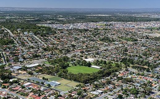
Wanneroo Local Area Plan

Wanneroo Local Area Plan endorsed by Council (Dec. 2020)
The City would like to thank community members who participated in the community engagement process to help shape the Wanneroo Local Area Plan (LAP).
Local Area Plans are a City initiative that aim to uncover what makes individual communities special, unique and distinctive.
Taking on board local priorities, the Plan will guide how the City provides local services, facilities and programs into the future.
More than 900 local residents participated in the Wanneroo LAP community engagement process held during February and March, with 20 people and businesses attending a Community Workshop.
This page had more than 1,800 project page visits, the interactive mapping tool received 65 comments and suggestions, and 140 people completed the community survey.
The mapping tool is now closed, but you are welcome to view the final results.
The Wanneroo Local Area Plan has now been endorsed by Council and will guide the future planning and operations of the area.
About the project
The City’s Strategic Community Plan places a strong emphasis on improving the distinctiveness of neighbourhoods, strengthening local character and improving the understanding and awareness of features, priorities and needs in our local communities.
To proactively address this, Council has adopted a ‘Place Approach’ to guide how the unique places across the City will be developed, managed and activated now and in the future.
The City is currently developing a Local Area Plan in close collaboration with residents and interested parties in the Wanneroo area. The Wanneroo Local Area Plan boundary, shown on the map below, reflects an area surrounding the Wanneroo Town Centre, including the Wanneroo Civic Centre, Showgrounds, Rotary Park, and the Wanneroo Library and Cultural Centre.
The aim of the Plan is to:
- provide information on what makes this Wanneroo area special to you;
- better understand what your community values about the local area;
- identify local priorities of your community; and
- ensure that service delivery (by the City and others) responds to key priorities.
Key Dates
Public comment period opened
26 January 2019 to 31 March 2020
Date: 09/02/2020
Community Workshop (No.2)
Wednesday, 23 September 2020, 5.30pm to 7.30pm at Wanneroo Civic Centre (For those only who participated in the 12 March workshop) - See Workshop Report attached
Date: 24/09/2020
Face-to-face Community Group meetings
10 February 2020 to 15 March 2020
Date: 09/03/2020
Community Workshop
Thursday, 12 March 2020, 5.30pm at Wanneroo Civic Centre.
Date: 16/03/2020
Public comment period - NOW CLOSED
COB Tuesday, 31 March 2020
Date: 01/04/2020
Project team analysis
March to July 2020
Date: 31/05/2020
Council Endorsement
15 December 2020
Date: 16/12/2020
Documents
Wanneroo Local Area Plan Community Workshop Report 258 KB
Wanneroo LAP Snapshot and Community Engagement Statistics 741 KB
Wanneroo Local Area Plan 12 March 2020 Workshop Report 299 KB
Wanneroo Local Area Plan Workshop Presentation 12 March 2020 1 MB
Boundary Map - Wanneroo Local Area Plan 21 KB
Wanneroo Place Profile 2020 5 MB
Interactive mapping tool guide 308 KB
Submit your comments
Please refer to the City's Rules of Engagement before submitting a comment.
Shared community comments
Subscribe to this project
Subscribe to receive updates on Wanneroo Local Area Plan
Subscribe to City news
Subscribe to receive City news including updates on projects.
Contact us directly
Use our Project Enquiry online form to contact us directly with any questions or comments.
Project contact
Name: Lorna Secrett, Place Specialist, Place Management
Telephone: 9405 5000
Email: enquiries@wanneroo.wa.gov.au