Coast

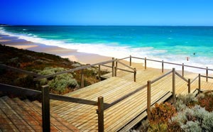
The City’s coast stretches 32 kilometres from Tamala Park in the south, to Two Rocks in the north. Wanneroo’s coastal foreshore is relatively undeveloped, especially when compared to the coastline further south. The City’s ocean coastline is an extraordinary natural asset for the City and has been an important stimulus to the urban growth of the coastal corridor. Due to climate change and an estimated rise in global sea levels, the City closely monitors and manages the coastline which is becoming increasingly more vulnerable.
- Coastal Management Plan
- Coastal Management
- Coastal Hazard Risk Management & Adaptation Plan (CHRMAP)
- Foreshore Management Plans
Coastal Management Plan
The City’s Coastal Management Plan (CMP) provides a framework to guide the management and use of the City’s coastline over the next 15 years. The CMP aims to balance the community’s enjoyment of the coast with the protection of the natural environment by facilitating access to the beach, and ensuring that development is sustainable and sympathetic to the coastal location and environment..
Coastal Management
The City of Wanneroo has a number of recently completed and ongoing coastal management works relating to the management of coastal erosion issues, maintenance of coastal protective structures and coastal monitoring.
- Beach Renourishment
- Central and Southern Jindalee - Beach Access Staircases
- Coastal Monitoring
- Feasibility Study for the Development of an Accessible Recreational Fishing Platform
- Mindarie Breakwater Management
- Quinns Beach Long Term Coastal Management
- Quinns Beach Sandbag Revetment Works
- Two Rocks Sea Wrack Management
- Yanchep Coastal Management
Coastal Hazard Risk Management & Adaptation Plan (CHRMAP)
The Coastal Hazard Risk Management & Adaptation Plan goes into further detail in regards to the specific issues affecting the City’s coast and makes a total of 13 recommendations for the management of the City’s coastline. These recommendations tie into the City’s Coastal Monitoring Program.
Further information can be found by clicking below:
Coastal Hazard Risk Management & Adaptation Plan (CHRMAP)
Foreshore Management Plans (FMP)
In addition to the work being carried out by the City, planning of the City’s coastline plays a large part in its ongoing monitoring and management. Foreshore Management Plans are a requirement for all developments affecting the coast and provide detail on future land uses within foreshore reserves with the aim to minimise the impacts of development.
See the Foreshore Management Plan Guidelines for more information on the process for assessment as well as the preparation and submission requirements for foreshore management plans. For a list of all FMPs that have been endorsed by Council to date and a map of the Wanneroo coastline that illustrates the applicable areas see below:
- Foreshore Management Plan Map
- Amberton Foreshore Management Plan
- Capricorn Yanchep Part 1 Report - Foreshore Management Plan
- Capricorn Yanchep Part 2 Appendices – Foreshore Management Plan
- Catalina Estate Coastal Access Foreshore Management Plan
- Lot 1 The Wharf, Mindarie Foreshore Management Plan
- Lot 9 Jindalee Foreshore Management Plan
- Lot 12 Jindalee Foreshore Management Plan
- Mindarie-Quinns Rocks Foreshore Management Plan
- North Alkimos Foreshore Management Plan